
It’s Day 4 at 1:08PM PST in the Yukon. This morning while I was lugging bags to the truck, one of the locals held the door open and said, “Welcome to the cold!” We completed a TSD this morning that I’m not feeling super confident about—I think the course was actually about half a mile shorter than the numbers they gave us.
So far, we are ranked 19th overall. We are elated to be that far ahead, neither of us having competed in a TSD before, or even knowing exactly what they entail. We are on our way to Dawson’s City up the Klondike Highway, an old goldrush town. We have to make it there before sundown to line up for an ice race. (Shhhh, we’re not racing, this is a rally! Racing isn’t legal…) It’s a timed event around the city, where Josh has to wear a helmet and get his best speed. This is a portion of the rally required to complete all stages and receive the “Arctic Award” at the end, which we are hoping to be able to accomplish.
Yesterday, Day 3, was a long one. We had only one TSD in the morning and looked over the rest of the directions for the day that included a lot of great recommendations for places to stop. There were several great lodges that serve hot food, hot springs, the “Welcome to the Yukon” sign, and a “sign forest,” trees where visitors leave their license plates (tags) from all over the world. We were excited to see that we could play tourist for a day and pull over to take photos.
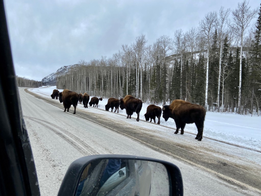
And photos we took. We had come to a white wonderland worthy of toy-making elves. Cerulean blue sky over tree-topped mountains blanketed in clean white. A view between two mountains, would reveal more white mountains stretching into infinity. Josh and I joked, “Look another majestic photo.” We stopped to take pictures of a pack of big-horned sheep trying to cross a frozen stream. Then, we saw our first bison, digging its nose in the snow, foraging for food. We must have watched the massive creature for ten minutes.
The Velvet Underground and REM played as we turned and dipped along and our radio said, “Mileage 1304—BISON!!!” And soon we came upon a pack of dozens of bison, digging in the snow and trotting along, their associates tucked deep in the trees to the right of us. I had my camera 10 feet from one as it walked by us. To me, this beast looked like doe-eyed snuffalufagus. (sp?) It took all of my good sense not to offer it carrots. We started back up on our way and saw another pack on the left, with nearly as many. Then further, yet another pack. And another. Josh told me that bison used to run through North America in packs of a million of more. Native Americans used to track them by following the sounds of thunder.

We pulled up to the hot springs and decided to just dip our feet in. We still have 300 miles to travel and we really didn’t have time to truly relax and swim there. But I think seeing the springs planted some seeds in Josh’s mind that he might enjoy a weekend trip visiting some near home. I’ll take it.
Day 3 we were headed across the top of BC and one of the mileage markers—“odos” as we say—is the sign for Yukon Territory border. I happened to be reading a book at the time, Peter Freuchen’s Book of the Eskimos, and missed calling out the odometer marker. Josh said, “We passed the sign!” and immediately swung into a wide U-turn and all of the sudden we were on the opposite side of the road, sliding into a ditch.
“Watch out!” I said, “We’ll get stuck!”
“We ARE stuck,” he said and immediately radioed out for help. Not 30 seconds later car 39 came along and swung around in front of us to pull us out. I had to climb out of the driver’s side, because snow was too deep. They warned us that sometimes the snowplows throw the snow over ditches in deceptive manner so that it looks like the shoulder of the road. We just learned that firsthand.

In three minutes, we were out of the ditch, and on our way again. We did go back and get the picture with the Yukon sign. Later, we learned that it was the crappy sign—there is a more official-looking one down the road. I’ll take our picture over one with that official sign any day, now we have a story to go with it.
Eventually, we met up with the Jeepers and made our way north. We saw two Elk scurry from the road as we passed. There were two more moose. And as the sky began to darken, we experienced our second whiteout in this journey. This landscape looks eerily like Naria once twilight comes, and I expect the Ice Queen to come whipping around a bend in her sleigh.
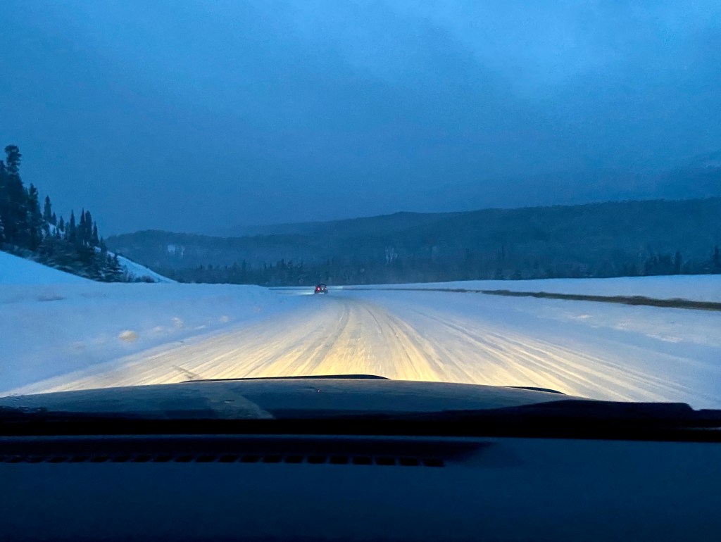
We did make the mistake of stopping for dinner, which took too long when you have 150 miles ahead. Josh and the guys tried Elk sausages and I ordered poutine. I think I ate three forkfuls before we climbed back in the vehicle and we didn’t get in to Whitehorse until 11:30. 11:30 is LATE when you still have several trips of gear to unload, a block warmer to plug in and math to do. Josh and I are sleeping hard, but very little.
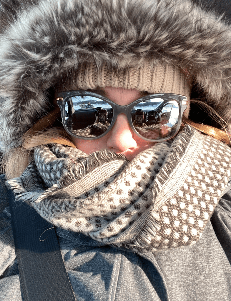
The cold part of our trip has officially commenced. This is my second day with long underwear and Josh’s first. The cold bites fast now and we have to keep our heads, ears and hands covered. It’s much harder to get warm, than stay warm.
The Klondike Highway heads due north and we are currently watching the trees get smaller and scrawnier. Since they have less daylight, the trees don’t grow as tall or strong. Slowly, the scenery is turning into tundra, the Arctic desert. We are driving through “dry snow.” It’s so cold it doesn’t get a chance to melt and turn into ice. It stays permanently powdery and they liken driving on it to gravel. It’s easier for the tires to grip onto.
Off to make the ice race…

Note: I’m uploading these photos at 7PM in Dawson City. While I was standing outside watching the race it dropped from -9 degrees F to -11. Currently it’s -17.
